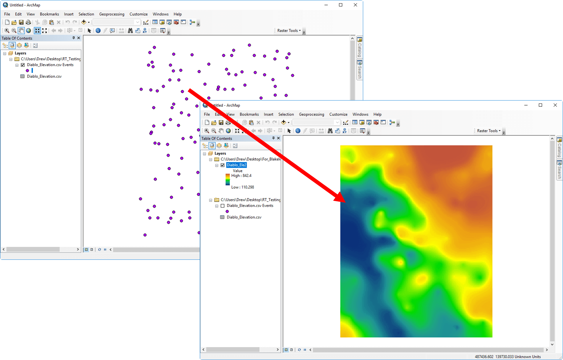
Raster Tools - 光栅绘图工具
光栅工具是一个Esri ArcGIS插件,它提供了更多的插值选项和更多的控制插值参数。12种不同的插值方法和大量的插值方法使得您对插值方法和参数有更多的控制。数据可以是定期的,也可以是不规则的XYZ数据或点特性集。它可以创建准确的光栅数据集。
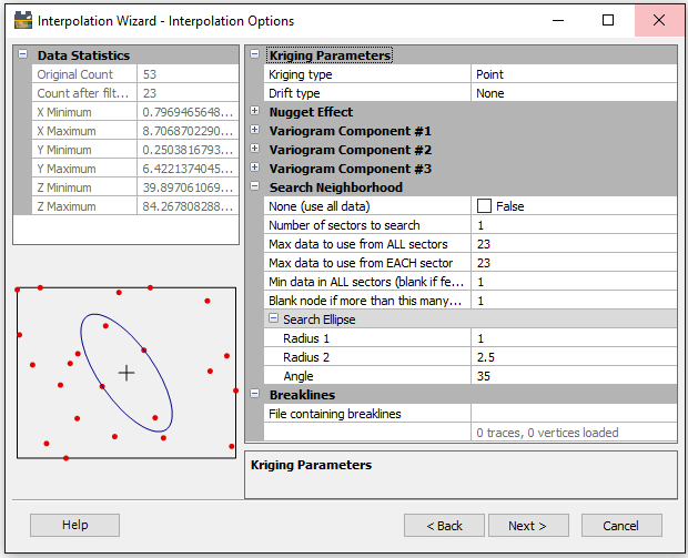
光栅工具还具有对插值参数的广泛控制,以确保准确表示数据。这些参数包括用于确定在插值操作期间考虑哪些数据点的搜索控制,在插值计算期间使用断裂线和故障的能力,以及用于沿指定方向应用优先权重的各向异性设置。
当您使用光栅工具创建光栅数据集时,您将获得真实数据的表示。
光栅工具帮助科学家和工程师将点数据转换为高质量的光栅数据集,并准备好进行映射和建模。
转换数据
创建栅格数据集。使用Raster Tools创建栅格数据集时,您将实现对实际数据的表示。Raster Tools是Esri ArcGIS加载项,为您提供更多插值选项和更多控制插值参数使用Raster Tools表示数据。

可信赖的解决方案
光栅工具的插值算法与在Surfer、2D和3D映射、建模和分析程序中发现的众所周知的算法是相同的。这些算法帮助科学家和工程师将点数据转换为的栅格数据集,用户随时可以进行映射和建模。
特征:
创建栅格数据集
光栅工具插值方法
反距离
Kriging
多项式回归
使用线性插值的三角测量
修改Shepard的方法
径向基函数
自然的邻居
移动平均线
数据度量
局部多项式
光栅工具插补功能
为Variogram模型拟合内插
各向同性或各向异性加权
用故障和断线进行插值
对搜索区域大小、形状和约束的控制
数据过滤
自动数据统计
重复的点处理
控制输出的几何和分辨率
创建ADF、IMG和TIF格式的莱斯特
简化工作流程
在单一的环境中工作。光栅工具直接在ArcGIS接口中操作。这个的工具可以让您完成整个光栅创建过程。通过几次鼠标点击,指定输入数据、搜索邻居和输出光栅数据集的内插参数,输出光栅会自动添加到您的地图中,并保存到个人和文件的地理数据库中。光栅工具可以简化您的工作流程。

Transform Data
Create accurate and precise raster datasets. When you create raster datasets with Raster Tools, you will achieve more complete and accurate representations of your real-life data. Raster Tools, an Esri ArcGIS add-in, gives you more interpolation options and more control interpolation parameters. Represent your data at its best with Raster Tools.
Trusted Solution
Raster Tool’s interpolation algorithms are the same, well-known algorithms found in Surfer, our 2D and 3D mapping, modeling, and analysis program. These algorithms have helped scientists and engineers across the globe transform point data into high-quality raster data sets, ready to be mapped and modeled.
Create High-Quality Raster Datasets
Have complete confidence in the accuracy of your raster dataset. Raster Tools, an Esri ArcGIS add-in, gives you more control over interpolation methods and parameters than what’s natively available. Twelve different interpolation methods and numerous interpolation options make it easy for you to create accurate rasters. Data can be either regularly or irregularly spaced XYZ data or point feature sets.


Raster Tools Interpolation Methods
Inverse Distance
Kriging
Minimum Curvature
Polynomial Regression
Triangulation with Linear Interpolation
Nearest Neighbor
Modified Shepard’s Method
Radial Basis Function
Natural Neighbor
Moving Average
Data Metrics
Local Polynomial

Streamlined Workflows
Work in a single environment. Raster Tools operates directly within the ArcGIS interface. This powerful tool steps you through the entire raster creation process. With a few clicks of the mouse, specify your interpolation parameters for input data, search neighborhood, and output raster datasets, and the output raster is automatically added to your map and saved to personal and file geodatabases. Raster Tools streamlines your workflows.
- 2025-05-30
- 2025-05-26
- 2025-05-21
- 2025-05-20
- 2025-05-16
- 2025-05-15
- 2025-05-22
- 2025-05-14
- 2025-05-07
- 2025-04-17
- 2025-04-15
- 2025-04-14


